Original Image Size: 16" x 26"
Limited Edition of 250
Image Size: 16" x 26"
Print Size: 16-1/2" x 26-1/2"
Limited Editions include a Certificate of Authenticity
Open Edition
Image Size: 9-1/2" x 15"
Print Size: 10" x 15-1/2"
Small
Image Size: 5" x 7"
Print Size: 5-1/4" x 7-1/4"
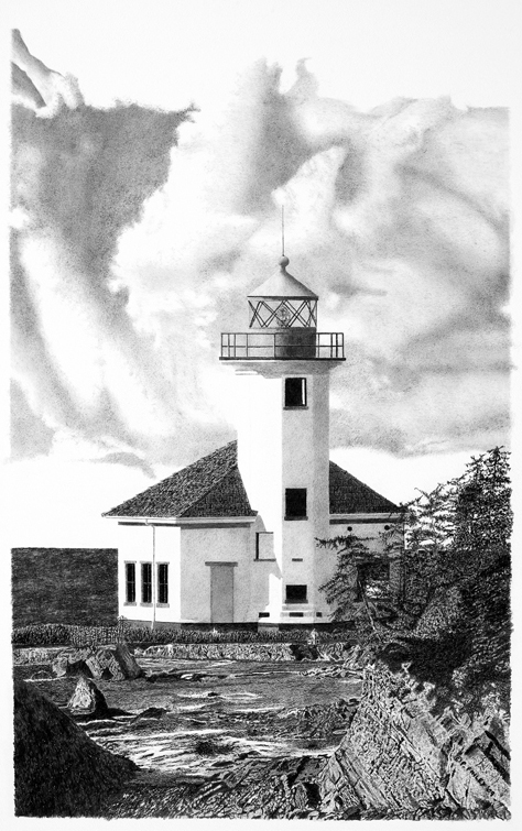
As one experiences all along the Oregon coast, there is scenery ranging from pristine inaccessible ruggedness to beautiful roadside beaches. There are places where you feel the openness and power of the ocean and other places where you have a sense of being in a safe harbor, an intimate place where you feel like you fit.
The history of Cape Arago and the Coos Bay area relates to that ruggedness and beauty, leaving a wonderful image in my mind of what it must have been like to live in a beautiful, pristine area with its moderate climate and lush abundance, and also helps to add a subtle personal dimension to my painting. Fortunately much of that is still there to experience.
As I started planning the painting, my first thought was that with the relatively inaccessible location of Cape Arago light how was I going to capture a sense of connection and intimacy. Well, by combining a scene that frames the distant view of the light with a larger view of it scaled to a size where it can be seen in detail, creates that intimacy and allows a connection with the light itself.
To enhance that connection, here are a few of the ever popular bits of information about names and dates that I’ve found: Three Cape Arago lights have been built on the islet known as “Chief’s Island” or “Lighthouse Island” over a period of 68 years. The original light was built in 1866 (it was the second light built on the Oregon coast after the Umpqua River lighthouse), the second was built in 1908, and the third in 1934. The original was then dynamited sometime after completion of the third light, and the second was razed in the 1960’s. The light was automated in 1966, and deactivated January 1, 2006.
“Cape Arago” was originally named as Cape Gregory (Gregory Point) for a Saints’ day (for Pope Saint Gregory the Great) by James Cook in 1778. William P. McArthur, a naval officer serving on the Coast Survey, charted the cape and named it Cape Arago on his 1850 maps, after the French physicist Francois Arago.